As the UK’s drought continues and the Maize for winter feed withers in the fields we need an alterative. Our farmers are already feeding winter food to their livestock. There is an option and it is called Duckweed. That green stuff floating in our ditches and rhynes. It may well provide the alterative to farmers having to cull their livestock or buy in expensive food, if they can find it?
Even if the rain comes now, August 2026, the loss of crops will still create feed shortage through the winter. With wetter warmer winters Duckweed may be the best hope to create the feed the farmers need.
Duckweed production provides: speed, protein, and simplicity.
Rapid growth — Duckweed can double its biomass in 24–48 hours under optimal conditions. That’s faster than soy, rye grass, alfalfa, or most forage crops.
High protein content — Depending on species, protein ranges from 25–45%, comparable to soy meal.
Low resource demand — It grows on shallow water with minimal inputs, making it ideal for marginal land or integrated farm systems.
Environmental benefits — It absorbs nitrogen and phosphorus, helping clean agricultural run-off.
For UK farmers facing tight margins and environmental regulation, this combination is compelling alongside the cost of deployment on fields too dry to cultivate and plant.
An existing setup
Scalable
It has been done before at scale. One of the most notable large‑scale experiments happened in the 1980s–1990s, when Nestlé supported duckweed cultivation systems in parts of South America, especially in Peru and Colombia.
Here’s what that system looked like:
Integrated lagoons — Farmers built shallow ponds fed by nutrient‑rich water from livestock or food‑processing waste streams. These can be simple plastic channels laid on the ground
Continuous harvesting — Duckweed was skimmed daily, dried, and mixed into feed for pigs, poultry, and fish.
Circular nutrient flow — Wastewater fed the duckweed; duckweed fed the animals; animals produced manure that fed the lagoons.
Low‑tech, high‑yield — The system required minimal machinery, making it accessible to smallholders.
Results: Farmers reported improved feed efficiency, reduced reliance on imported feed, and cleaner water leaving the farms. Nestlé’s interest was tied to stabilising local supply chains and improving sustainability metrics long before ESG became mainstream.
The UK can borrow heavily from this model — but with modern upgrades. The author has since 2015 been involved in providing project vision and supporting the design of Duckweed schemes in Peru, Jordon, South Sudan , India and other countries with water and food poverty.
Why Duckweed Fits the UK’s Agricultural Landscape
The UK has several structural advantages that make duckweed adoption easier than in many countries:
Abundant rainfall → consistent water availability for ponds. Our warmer wet winters deliver that water.
High livestock density → steady nutrient streams for duckweed growth.
Pressure to reduce soy imports → duckweed offers a domestic alternative.
Strong research institutions → ideal for optimising strains and systems including Brymore Academy.
Contractors and farmers able to install the systems quickly and efficiently.
No Effluent
Duckweed can be integrated into:
Mixed farms — where nutrient flows are already diverse.
Dairy farms — using slurry lagoons as growth beds.
Poultry operations — replacing part of soy meal.
Aquaculture — especially trout and carp systems.
How do you produce Duckweed?
at the most basic level a channel/ raceway with a water containing nutrients being being forced around a channel with Duckweed growing on the surface. 25% is harvested every day.
The plan shows a typical closed circulating raceway,
Growing medium can be water with added nutrients or effluent containing nutrients that duckweed will clean as part of the duckweed production process.
How do you feed livestock with Duckweed?
collect it daily,
a quick wash, using water you have already cleaned.
press to remove free water and it can be fed wet directly to livestock.
No complicated machinery and what equipment is needed can be fabricated by a competent local fabricator.
Duckweed will clean water
Duckweed is a fast-growing aquatic plant that naturally purifies water by absorbing excess nutrients, heavy metals, and other pollutants, making it an effective and sustainable water-cleaning solution.
It can clean effluent. Be used as sewage treatment plant because it converts nutrients to high protein biomass.
Mechanisms of Water Purification
Duckweed, belonging to the Lemnaceae family, cleans water primarily through phytoremediation, where it absorbs contaminants directly from the water column. It rapidly takes up nitrogen and phosphorus, which are major contributors to algal blooms and eutrophication, effectively reducing these nutrients by up to 63–65% in wastewater over a few weeks earthecobalance.com+2. The plant also absorbs ammonia, heavy metals, boron, and organic chemicals, helping to protect aquatic life and improve water quality earthecobalance.com+2.
Physical and Ecological Benefits
Duckweed forms dense mats on the water surface, which block sunlight and suppress algae growth, improving water clarity and oxygen levels biologyinsights.com+1. Its small root systems stabilise water, reduce turbulence, and allow suspended solids to settle, further enhancing purification biologyinsights.com. By trapping pollutants in its biomass, duckweed acts like a natural sponge, though regular harvesting is necessary to prevent re-release of stored contaminants earthecobalance.com.
Applications
Duckweed is used in wastewater treatment systems, agricultural ponds, and small-scale fish farms, offering a low-cost, environmentally friendly alternative to chemical treatments. It can remove up to 84% of chemical oxygen demand (COD), 87% of total nitrogen, and 85% of total phosphorus in controlled studies, demonstrating its effectiveness in both municipal and rural settings impress-he.eu. Additionally, harvested duckweed biomass can be repurposed as fertiliser, animal feed, or even human food, adding value to its water-cleaning role earthecobalance.com+1.
Summary
Duckweed is a multifunctional, sustainable solution for water purification. Its rapid growth, nutrient absorption, and pollutant-trapping abilities make it ideal for improving water quality in ponds, rivers, lakes, and wastewater systems, while also providing ecological and economic benefits earthecobalance.com+3.
updated 20 09 2025 – Woolavington East planning application 54-25-00014
Proposed Developments
Woolavington is a large Somerset Village currently subject to five proposed housing developments all of which with the exception of the associated Gravity housing element have been proposed without any wider cognizance or consideration of the adjacent village and how their proposals should fit together.
Development is also a consequence of the new Bridgwater Tidal Barrier forcing development (5000 houses) that should be north of Chilton Trinity and connected to Dunball/jct 23 being forced out of Bridgwater by the failure of Sedgemoor District Council and the pursuit of environmental objectives of the EA and associated nature businesses to adequately consider the wider impacts of it’s decisions on the wider area.
Woolavington is fast becoming the perfect example of the failure to deliver any form of control or vision for the future whilst the public only gets to see individual bits of a wider picture when asked to comment. They represent the continuing failure of the UK’s housing model to provide a wide and affordable housing offer that places the UK at the bottom of Europe’s housing offer in terms of sustainability, affordability, and width of offer.
It is a house or house regardless of one’s age or circumstances.
Ignoring planning policy, that will come later when these schemes attempt to move to planning applications and best dealt with there. The present consultations seek public engagement; this post attempts to look at the wider context of some of these proposals and how they bring nothing to the host community of Woolavington.
Woolavington: planned and proposed housing and Gravity site.
Note: Some individual properties may be within but not part of the indicated wider Persimmon scheme
Each development promotes its proximity to the Agratas Giga Factory as a factor regarding need despite a clear message within the gravity development plans that it expects people to commute in a sustainable manner even providing a railway station and cycle paths. It is worth noting that the when the Gravity site was a munitions factory employing 4000 people and the original estate had been built by the UK government on top of Woolavington Hill the workforce was bussed in from surrounding towns. No wider car ownership in those days.
Despite all of the housing being proposed by developers and the Wainright application 54/19/00008 lapsing no other developer is proposing to construct a new roundabout at Woolavington corner, the junction of the B3141 with the A39.
All developments except Gravity are silent regarding this increasing traffic on the unclassified roads in and out of the village and in particular the unclassified road between Woolavington and Puriton. Equally the larger proposed Persimmon development will use the same road to travel east.
Each development talks about public space, exercise on the use of bicycles etc. The usual things. The potential to link to Cossington’s cycleway on the old Somerset & Dorset permanent way ignored. Only the proposals for the Gravity site have any detail and any hope of being built as they already form part of the development agreement for the site. The other four developments including the one that has lapsed form a disjointed and disparate set of proposals that may or may not come to fruition. What we do know is there is no single guiding light behind this village might improve and benefit from these developments. It is an unfolding planning disaster.
Woolavington – Geography and Geology
It is important to understand that Woolavington is one of a series of Polden Hills villages that form a string of north facing spring line settlements from Puriton to Shapwick.
If you drive from Woolavington to Street you will notice that all the old houses are to the left and at the foot of the hills. So called because the Polden Hills ground water comes out of the ground towards the bottom of the hill. The water in the old village well on what is called the batch is usually just 1m below ground level. and can be easily checkedif so inclined . The old 1913 ordnance survey map below shows the many wells (W and P) that provided drinking water. These wells are shallow and receive their water from the near surface ground water within the lias rock that makes up the Polden Hills. The relevance of this geology and groundwater migration will become apparent later.
Section looking west through Woolavington Hill and how the village developed.
1913 OS Map of Woolavington
“P” means a well under and “W” means a well.
Radon. The revised Radon map is shown below. The proposed developments will be in high Raydon areas. Construction releases Radon gas and being denser than air will migrate northward and down the hill into the existing village. https://juta.co.uk/juta-news/what-is-radon/
Woolavington lies on the north facing slope presently rapidly drains to the Levels below with water courses rarely holding water. As such there is little standing water.
The current proposals propose to use the SUDs system of ponds/pit to attenuate flows will change this as these ponds really do not work with any degree of speed resulting in
The creation of stagnant water suitable for the breeding of mosquitoes that now carry many dieases new to the UK. This risk could be attenuated by discharging to the Levels albeit with the consquence oof loweing grownd water levels. It is a complicated balance that developers and the LA simply ignored having been pemitted on application 54/119/00008 https://ukhsa.blog.gov.uk/2023/12/11/health-effects-of-climate-change-the-health-threat-from-vector-borne-diseases/
This type of housing is a singularly unpleasant way of degrading the environment notwithstanding now the construction of these houses involving the cutting into the underlying rock to form foundations and drains will invariably release large amounts of surface water and as a consquence lower the existing groundwater with the detrimental effects on the habitat on the hills side. However a small crumb of comfort is Condition 16 of planning application 54/19/00008 that seemingly makes residents of developments responsible for their drainage system if implemented on these new schemes creating a path for reparations to those impacted by the developers use of pits rather than the alternative of direct discharge of runoff to the Levels.
Large amounts of surface water running on the road are already a problem in Woolavington on these proposals what scene designed to make the situation worse. It is difficult not to appreciate the irony a statement such as net biodiversity gain when the development model is likely to have a far wider negative impact beyond the boundary of these developments.
Map of Woolavington showing house building consultations east of the B3141
Bloor homes propose to build 150 houses on top of Woolavington Hill and suggests that this development will provide worker accommodation for the nearby Agratas giga factory presently under construction at Puriton.
As a proposal it does not reflect the needs of the village. With an older population there is a considerable need to downsize that would free up houses that this scheme and others purports to address. 150 homes could be provided by 4 to 5 apartment blocks rather than 150 unneeded houses.
Highways
Access to the development will be from the unclassified road between Woolavington and Cossington. The proposal neglects to mention that in order to reach the Giga factory from this site drivers will invariably take the shortest route and that is the unclassified road between Woolavington and Puriton. This road will also be used by people living on Gravity’s 725 housing units on the Gravity site, the 1400 units on the planned Persimmon site and the 170 houses on the Woolavington East site Weather where traffic from the northern part of that development will seek to cross the B3141.
Following the lapse of planning consent 54/19/00008 the requirement for modifying the junction between the B3141 and the A39 should be placed on this development or the East Woolavington site depending on which site comes first if both were permitted.
Landscape
With climate change any drainage system within the village should discharge the full volume immediately to the Somerset Levels. The vague suggestion of discharge into a watercourse that has no description and might be assumed to be nothing more than an open soak away discharging highway run off into the groundwater is unacceptable. All highway runoff should be fully treated to remove the chemicals before being allowed to enter water courses and invariably contaminate the groundwater below.
This is a land promoter’s speculative proposed development of 170 dwellings on 2 fields of around 8.4 Ha (21 Acres) to the east of Woolavington Hill seeks to create a single development crossing the main agriculture route, Combe Lane, that connects Woolavington and Cossington Levels through the northern part of the development. It seeks to gain access to the B3141 via two substandard road junctions.
It is a proposal that has been put together with no consultation with the local industry adjacent to it and who will be negatively impacted should it be permitted. It represents the worst of all approaches to development that rather than work with people and preserve rural employment it chooses to run roughshod over their interests and threaten their livelihoods through the invariable conflict between homeowners and employment centres.
This is presented as a Business Park – it is not. It is joinery factory that has been there for 30 years with loud machines and 14 full time employees that this proposal threatens.
This is presented as a Business Park – it is not. It is a single operator site
The public consultation appears to be little more that a way to get the public to do the work the proposers agents should have completed before going public with its consultation.
As a proposal it does not reflect the needs of the village. With an older population there is a considerable need to downsize that would free up existing houses that this scheme and others purports to address. 170 homes could be provided by 4 to 5 apartment blocks rather than 170 unneeded houses and have minimal impact on the environment.
It makes the statements about EV’s yet the population is ageing and by 2050 30% of our population will be over 65 on reduced incomes whilst the impacts of AI will have further reduced the ability of people through unemployment to own and operate a vehicle of any kind. Just imagine that this development and the others imagine that in order to live in a home they must purchase maintain operate and drive a vehicle all funded from a pension regardless of their age and circumstances. This development does not even allow for bus to go through it. It is a fantasy based on the assumption that the near future will look like the recent past when clearly that is not possible. The statements based on information from the ONS and other reputable sources indicate that they are incorrect.
Statements about decarbonising are made. It is simply not possible to decarbonise any car-based housing development where each dwelling will create on average 1.2 additional cars increasing embodied carbon and having high annual operational carbon due to the need to drive everywhere. The geology is such is that there will be massive over break when excavating foundations increasing the volumes of embodied carbon. Almost none of the statements in this consultation stands up to scrutiny or are explained in any detail.
Building this type of housing in a village and pretending it is sustainable is simply not credible. There is nothing sustainable about car dependent low rise housing.
Following the lapse of planning consent 54/19/00008 the requirement for modifying the junction between the B3141 and the A39 should be placed on this development or the East Woolavington site depending on which site comes first in the event that both were permitted.
North Section
Housing
The developer seeks to construct lower density housing (15) at the North End of the North field. This housing will back directly onto the industrial site and will invariably bring into conflict the occupants of these houses and the industrial activity of the joinery works to the west. Previous applications for housing in this area have taken cognizance of these industrial processes and been refused.
Road Access
The Promoter proposes a new access into Vicarage Rd (5) that obstructs and interferes with the operations of the adjoining joinery works. Vicarage Rd is an unclassified road that exits onto Woolavington Hill (B3141) where visibility is particularly bad. The road is also too narrow and the gradients from the B3141 junction exceeding good practise and there is insufficient width to satisfy highway requirements. The Promoter has shown no enthusiasm to improve the road or more importantly improve the junction with the B3141. It seems that no land has been aquired or is under the control of the propmoter to permit the construction of a safe access.
Combe Lane
The promoter (not the final developer) and agent shows no apparent understanding of the function of this road. Combe Lane provides the essential link for agricultural between the Woolavington (500Ha) and Cossington Levels. (300Ha) Although only a single track it keeps the ever increasing tractors and trailers separate from the housing within the villages. Access to Combe Lane at Woolavington Hill is where the gradient of the hillside is at its least and safest whilst the Promoter proposes to move it to the steepest part of the hillside and where turning farm vechicles is at most dangerous. Making something more dangerous is hardly what people imagine and that is exactly what is being proposed. The map below shows how our local agricultural industry flows through Combe Lane. This lane keeps people safe and separate.
The traffic study appears to have lasted 4 hours on a wet afternoon in September 2024.
Main agricultural routes around Woolavington.
Combe Lane Junction at Woolavington Hill (B3141)
what happens when Agriculture meets Housing
This is what happens and has done so before on Woolavington Hill.
Landscape
The developer suggests that the use of attenuation basins at low points with parcels designed for biodiversity net gain is a way forward. This area is already prone to flooding with runoff leaving the field and eventually discharging to the levels via School Lane and Reeds Drove. This proposal will invariably pollute the existing groundwater and the many local wells. It will also create standing water suitable for the breeding of mosquitoes due to climate change are becoming more prolific in the UK and now carrying a number of dangerous diseases. With climate change any drainage system within the village should discharge the full volume immediately to the Somerset levels that starts at the bottom of Reed Drove.
South Section
Road Access
The developer proposes an equally poor solution to the B3141 that doesn’t comply with Highway Standards. It seems that no land has been aquired or is under the control of the propmoter to permit the construction of a safe access.
Landscape
The developer suggests that the use of attenuation basins at low points with parcels designed for biodiversity net gain is a way forward. This area is already prone to flooding with runoff leaving the field and eventually discharging to the levels via School Lane and Reeds Drove.
This proposal will invariably pollute the existing groundwater and the many local wells. It will also create standing water suitable for the breeding of mosquitoes due to climate change are becoming more prolific in the UK and now carrying a number of dangerous diseases. This proposal will fundamentally change the environment for the existing people within the village and those who might occupy the development. Clearly there is no investigation work regarding the geology of the site because the proposal would understand but the use of Suds as proposed is neither sustainable or to be encouraged.
Directly to the north active springs continuously discharge ground water through existing properties to the north of the south section,
The surface wate drainage system should discharge the full volume from this part of the site immediately to the Somerset levels via Woolavington Hill.
85 houses accessing an unclassified road (Woolavington Road/Higher Road) that all the the other promoted developments described here will used for primary access to work, shops (Woolavington COOP) and school. The only redeeming feature of this location will be that people can walk to the doctors surgery.
Drainage
The use of open drainage basins suggested to deal with stormwater. No investigative work has been done that would confirm the unsuitability of this situation. It is unfortunate that the promoter has already used this strategy at Puriton/
Summary
None of the proposals described produce a coherent and compelling reasons to come forward and the lack of any joined up thinking simply exacerbates the problem.
They all
pretend they are self contained and meet a need.
maximise embodied and operational carbon , (twice ad bad as the average EU home)
maximise transport poverty pretending that every house holder/occupant will have a car
have pretend cycleways that dont join up to anything
will contaminate ground water
offer no improvements to traffic especially at Woolavington Corner and the junction with Woolavington Road.
ignore climate change (UK developers are stil building south facing houses)
As someone with an interest in seeing Woolavington prosper it seems the village is destined to become a large poorly connected sink housing estate slowly poisoning the environment and habitat that will invariably fail to deliver what an ageing and poorer population needs.
There cannot be a crisis because if there was we would be doing something different because that is what a crisis demands.
The UK has a manufactured housing shortage. Building houses caused it. Building more houses won’t solve it. This is because unlike Europe and other advanced nations the UK to all extents and purposes exclusively builds low rise car dependent houses colloquially known as “single family homes”. Built exclusively for the ambulant car owning sector of the population. It is a narrow housing offer based on a post war Boomer demand that is now over. However sufficient demand exists as much of our existing 26M houses is blocked by ageing Boomers with no realistic option to move somewhere more appropriate and stay within their community.
Some Background
Demographics, technology and the desire/ need for non car dependent lifestyle is ignored by UK politicians and developers alike. In Europe apartments make up 40 -60% of homes. It is probably no accident that the countries now struggling the most are those with a similar car-based low rise housing model. US, Canada, Australia and New Zealand. Countries wedded to the idea of the shortcake house with a lawn back and front.
It should not be a surprise that advanced states such as Germany, New Zealand and California are squeezing out houses and in Germany even considering banning them. Yet in the UK we trumpet and pursue this form of housing seemingly happy to be the world’s worst outlier in terms of housing. No state is as bad as the UK. No state so self-disillusioned to believe that its housing offer is the right one. No state happier pouring mindless volumes of concrete into the ground. No state placing ever greater demands on the future generation when its then smaller tax base will struggle even more than it does today. It is not as if we don’t have a choice. We do but seemingly don’t care about the future just today. Politicians gullibly support national house builders and fail to ask them why we have ended up where we have.
With a new government seemingly devoted to nett zero we have now arrived at The UK Housing Paradox.
“Pursuing Nett Zero whilst choosing to build Europe’s least sustainable housing (2x the EU average embodied carbon) that maximises embodied and operational carbon, transport poverty and car ownership.”
If there wasn’t choice maybe there could be some justification but there is and there isn’t.
Houses (Single Family Units)
Houses are expensive and even the UK’s smallest and cheapest is expensive compared to an apartment not withstanding that every house requires a piece of road in front of it. The UK ones are appallingly expensive, appallingly small and of equally appalling quality.
Apartment blocks need much less infrastructure in terms of highway, services, drains than houses. It is little wonder that not only are UK houses more expensive they have 2X the embodied carbon of the average EU Home. Houses generate more CO2 than apartments as the graph below shows.
What is clear that whilst other countries developed and broadened their housing offer the UK housing offer remained with a few noticeable city exceptions at 2 story’s. Medium rise (5 – 10 story) housing makes up between 40-60% of European countries housing offer. Affordable housing where a car was not necessary to live there. If you can afford a car you dont need affordable housing. A client recently noted that it was easy to spot UK affordable homes as they were the ones with new or expensive cars on the driveways.
Historically the UK housing model was largely the invention of London’s railway companies who invented the suburb. Expanses of low-density low-rise identikit houses. The result is that London has a population density less than half that of Paris. It was a model followed post WW2 and suited the Boomer generation and did not require skill or planning to deliver it and most importantly the least working capital. It fitted the British anti investment mentality. The pattern was set for the problem we have today.
Why didn’t it change?
About 40 years ago a property developer and fellow college student explained that what the UK builds is the most profitable for the developer (why would you build something that wasn’t?). Even a terrace is avoided.
The reasons are simply and solely for the benefit of the developer.
It requires the least amount of working capital to develop a site. Apartment block and terraces needed to be finished before sales are completed. A house requires far less money before the investment is recovered.
Production of houses can be adjusted to suit changing market conditions. The procurement system allows work to be stopped and started as required.
Sites need to last 3-5 years whilst the next one is brought online; the sales/build rate is throttled by price adjustment to ensure that presence is continually maintained.
It is a low-tech winning formula that makes money.
There is almost no product liability associated with individual houses.
The result is houses. Lots of houses and little else. A sea of houses best summed up by an Italian colleague who on first seeing a UK housing estate remarked. “so many buildings so few people”. Houses are built only for profit and a narrow customer band. Developers are simply mining a diminishing market leaving people trapped in the houses they have previousl built over the last generation or two. It is little wonder that housing developments that offer nothing for the local population are so ardently resisted.
Two graphics below that both compare the UK with Europe illustrate the problem.
The first is from the Financial Times using ONS data on housing.
The simple fact is that Europe has a wider housing offer with a lower financial entry level that is cheaper, faster and more sustainable to build. It is not a difficult correlation to make that countries with a higher proportion of apartments have less of a housing shortage. Our “only houses” offer is the problem. Building more of a failed solution is not going to fix the shortage.
Instead, we Brits satisfy “The definition of insanity is doing the same experiment and expecting different results.” ― Albert Einstein where we continue to perpetuate the construction of expensive carbon max (2X European average) pokiest housing where you have to own a car to live there.
The consequence of the narrow UK housing offer is that
We have a shortage of affordable housing. It is madness to build affordable housing that still requires the occupant to commit 25% of their gross income to owning a car. Affordable cars that with will disappear with the last petrol and diesel cars (circa 2040) a mere 15 years away.
It encourages house blocking compared to first world countries like Europe where there are generational options through life. There is no obvious progression from house to non-car dependent spacious apartment. We need housing close to established transport and amenity hubs and where no new infrastructure is required. Reusing existing embodied carbon economically and climate wise is the obvious best option. Yet we build the opposite. We could do it but we choose not to because those solutions rightly dont provide the maximum profits.
The idiocy of the UK solution is the constant need to build schools as the older population blocks housing in school catchments. Converted schools litter the countryside.
The average UK house has 1.2 cars per household. About 10T of embodied carbon plus operational carbon per house.
The need for avoidable roads. Roads that use oil-based binders to create the surface. There is no credible alternative yet in sight. Will we return to cobbled roads and pavements?
Income that could be diverted to jobs, diet, a healthy lifestyle and maintaining the economy of our high streets is instead used to pay for power, car insurance and loans. As an example, the cost of running a UK car is around £4K per annum, £5k before tax. If 1M non car dependent homes were built this would potentially release £5B a year into local economies notwithstanding the reduced demand on the NHS that a better lifestyle and greater disposable income would bring.
Houses won’t solve the housing problem because
Changing demographics, old people don’t drive or do stairs.
People want or can only afford car free lives.
Nimbyism. They meet planning resistance because nobody sees the benefit. It just more of the same.
Housing estates require new roads and infrastructure before house construction can start.
A thought:
The UK has 30M largely car dependent houses. Many of those built after WW2 and before 1976 are low quality and vulnerable to climate change. Between 1946 and 1979, a total of 5,804,150 houses were built in the UK.
Cornish Type 1 – worth keeping? No.
Observe the sagging ridge lines and know about the shallow foundations and well documented floor defects of these houses and bungalows and we know they are well past their design lives. The original TRADA roofs designed for light clay tiles are simply not up to the addition of PV (solar panels and insulation) let alone retiled with concrete tiles. A perverse action undertaken by many authorites where perfectly good clay tiles are replaced with concrete tiles. The recovered clay tiles then recycled to new expensive 3 and 4 bed houses.
It is irrational to try and improve such old buildings. The argument for improvement rather than a wider holistic consideration of housing in the move to nett zero seems vested in self-interests. Academic support of improvement of the existing housing stock ensures the perpetuation of the greenfield development model. We apply ridiculous values to the minimal embodied carbon of these houses and bungalows whilst building carbon intensive roads and bridges and massive concrete foundations under houses whilst the superstructures decrease in weight.
What these old buildings do have is roads and infrastructure. Usually within 1 or 2 km of the nearest amenity and transport hub. Built and ready to go. These houses and bungalows represent land that could be rapidly exploited. Require little planning effort and exploit the changing trends of demographics and society.
No complicated 106 agreements needed when the development consists of 4 or 5 properties assembled by the owners. 5 homes become 30 in 6 months. Why the owners? Because with £5.5T about to move generations as the Boomers die out why not harness that money with an inheritance tax concession that gives the whole country a stake in the solution rather than housebuilders shareholders.
How many homes do we need?
The UK estimates that we need 300,000 homes a year. That is 3M for the next 10 years.
In addition to our normal housing demand, we might expect to see a further 30M MENA climate migrants (400M are running out of food water there) come to the UK. In order to house our population, we probably need around 15M homes. 30 to 40% wont drive.
Personal Transport
As we become too old and too poor to drive options like Zoox autonomous cars will become the affordable pay as you go transport of choice. It will drive the change that should already be happening.
This apparent conflict is simply the result of the narrow UK housing offer.
There are two misconceptions in this artifical war.
1) A bunch of old people hold up the provision of new homes is perhaps the greatest misrepresentation of the housing industry. It is simply not true. The houses the Yimbys want and need already exist. What doesn’t exist is the route for the older parts of our society to get out of them and make them available whilst remaining in their communities.
2) Developers are some sort of benevolent altruistic organisations trying to solve the housing shortage. They are not. The shortage of affordable housing has been manufactured by the UK industry in order to maximise demand for the most profitable product – the 3 and 4 bedroom house.
The trick to freeing up housing in a community is not to build for the young but for the older increasing segment of society and those who would live car free lifestyles. The migration of the house blockers would provide the homes the Yimbys want.
What developers get from this conflict is to build more unnecessary but profitable 3 and 4 bed houses with government clearing away dissenters.
Rural Housing
There can be nothing more entitled than the demand for rural housing.
In the UK there is almost no need for anyone to live in the country. Across Europe we have seen the countryside empty. Not so the UK where it is nothing but a lifestyle choice; one that is subsidised by the urban population many of who are less well off than those that now live in the countryside. A situation that has reversed in the last 50 years due to the availability cheap of fuel and cars. A situation coming to an end and time for the countryside to return to its industrial agricultural use and become once again somewhere to escape from rather than a theme park to escape to.
Why subsidised? So called rural dwellers pay the same for utilities, water, they drive farther and have greater operational carbon footprints. How is it possible that a rubbish bin costs the same to empty in a village than a city estate? It is not possible.
Not only is rural housing environmentally and carbon wise the worst housing solution but Governments that seeks nett zero support this worst housing of all with additional financial support. Rural Housing maximises embodied, operational carbon and transport poverty. It seems to have missed the policy makers attention that universal car ownership will fall dramatically and many lifestyles dependent on cheap cars will no longer be viable. Politicians need to travel beyond the M25 occasionally.
A solution
Most countries dont see houses as a solution and neither should we. We need to stop building houses, increase the density of our population and not continue to build what amounts to some form of future open prison as demographics, migration and decreasing car ownership reshapes society.
Replacing 3M of our substandard houses each with 6 apartments would generate the housing we need. Avoid 3M upgrade costs and create +15M new homes. This would save around 23,000 Km of new roads. 36M Tons of embodied carbon. It would create a fair and more inclusive society, yet no politician seems able to grasp simple demographics.
Imagine
15M homes (apartments) that would not require a greenfield site to be used or a new road to be built. It would reinvigorate our high streets using disposable income from carbon saving focused on local businesses.
15M apartments that would still leave the UK almost at the bottom of the EU table where the ratio of apartments to houses is concerned
There is a famous saying “Never ASSUME, because when you ASSUME, you make an ass of you and me.” Today there seems to be an assumption that the near future will look the same as the recent past. Electric vehicles will simply replace petrol and diesel ones and life will carry on as before. It is an assumption that is about to make an ass out of all of us. If nothing else the last 15 months of living with Covid-19 has shown us how quickly things can change when it’s necessary.
Current UK housing assumes car ownership. Today to own or occupy a house you need to own or have access to a car. This is especially true as our ever-spreading sprawling housing estates move us ever more distant from the facilities we need for everyday life. This is an assumption that does not stand up to examination because three things are now driving change that will see car ownership plummet and with it the desirability of estate and rural living.
1. Our Ageing Population
The Office of National Statistics estimates that over the next 50 years another 12.5m people will be over 65. This will reduce the number of drivers / car owners
UK housing is simply not suitable to grow old in. The UK has some of the smallest homes in the world. There is no room to fall or live with a wheelchair. As more boomers consider downsizing they will come to the conclusion that the new houses on offer isn’t a viable option for an ageing population. Consider how that small compact en-suite becomes a death trap as you move into old age or become in-firmed. The next time you sit on the toilet ask yourself “if you collapsed could someone get into to help you?”. Could a carer help you? The answer is invariably No. Inward opening doors will kill you. Check out if installing a stair lift is a viable option to delay your incarceration in the prison of your children’s choice.
2. Climate Change
Decarbonisation of the economy will reduce car ownership because
The end of new petrol and diesel cars (2030) will see demand for fuel decline. This decline will cause the cost of fuel to go up as refining of hydrocarbons needs volume to be profitable. Availability will go down as multiple fuel stations have insufficient throughput to survive; many are already more convenience store than petrol station. It will simple become too expensive to run the last traditional car that will probably have all but disappeared from our roads by 2045. The average lifespan of a UK car is 15 years.
We have all seen that new EV’s aren’t cheap. The battery is the expensive bit and at present lasts about 10 years (no doubt they will last longer as technology improves). Today a ten or even a fifteen year old car provides an economic and viable transport option for many people. In the future that affordable option will not exist as the cost of replacing the EV’s battery is almost the same as a new car. Low-income households running multiple older cars will simple not be able to afford to rely on the continuing availability of a steady stream of affordable used cars. Transport poverty will now drive the choice of homes we buy.
3. AI technologies
In the coming decade(s) AI technologies will take many of the jobs of those of working age. Autonomous trucks don’t just replace drivers but reduce the number of trucks by around 40% as they will now run 24 hours a day and not on the drivers legal hours. These trucks don’t need truck stops for food and rest. All those support jobs will go. Similar job loses can be expected in the legal, medical and construction industries. The resulting drop in household and UK PLC incomes as well as fewer commuters as people increasingly work from home we will see car ownership and the number of new cars decline significantly.
Self-driving AI cars that can be rented by the hour will provide a halfway house between car and no car. Call the car and it will turn up and take you to your destination. It’s a Pay as you Go solution and when compared to the annual cost of around £5k to run a small car you can do a lot of trips for £5K. Car ownership will plummet. Zoox.com will lead the way.
Conclusion
There is no doubt that climate change, demographics and technology will bring to an end the traditional British housing estate not because people won’t want them. As a viable living space they will simply be increasingly socially and economically unaffordable.
Tipping Point
There is a tipping point coming where multiple elements of our society will find themselves living in the wrong place, the wrong house and without accessible affordable transport. Too far from a bus route. Too old to drive and personal cars too expensive with the limited disposable income we will be left with a few uncomfortable options;
Own the sort of EV’s that dominates China, a car little bigger than a large mobility scooter.
yellow Smart car
Live in increasing isolation where leaving the house becomes an increasing rare treat. Only Amazon and your food delivery company will know you are alive. Your house will have become unsaleable as all those groups with transport poverty realise that your private house is just not worth it.
Or find a solution
The Solution
The UK is addicted to low rise housing and has demonised apartments whist accepting ever smaller houses. It’s no different than chocolate bars where the price remains constant but the product continues to get smaller. Admitting the situation is the first stage of recovery to any addiction. Shrinking houses have barely improved in 40 years. In comparison simply look at a 40 year old car and today’s offer from a car manufacturer. The difference is stark, not so UK housing.
Recognising the inadequacy of the UK housing offer and understanding the new drivers is the first stage of delivering the change needed to meet the challenges we face.
Affordability
Affordability will no longer be just about the cost of the house and most other costs being equal but the cost of living at your address will be impacted by transport costs. We will find that the proximity to a fixed bus route, safe cycleway or simply being within walking distance of frequent destinations that negates the need for a car will become the key selection criteria.
People need to retain more of their disposable income. Increasing disposal income will improve our desperate high streets and let us lead better lives.
Other solutions such as autonmous cars such abeing developed by Zoox will provide a viable alternatives to personal cars.
Energy costs.
Houses and bungalows compared to apartments and flats are inefficient energy wise. Developers don’t even offer a solar system to heat a daily tank of water.
Size
UK housing is too small for an anyone other than the smallest household unit. We need to increase the size of apartment and balconies where the benefits of single level living can allow people to live safely and independently longer.
Location
The assumption that home owners are also car owners will go. The reality is that we need to be with a mile or so from towns and shops. The ability to walk, cycle or indeed use a mobility scooter offers the least cost solution and greater disposable income and ultimately a better quality of life.
It’s now time to stop building out and start building up.
It doesn’t have to be sky scraper but it does need
1) a lift to allow the elderly and young families with young children to use the upper floors
2) a large balcony where its possible to sit , grow plants and entertain.
3) to be of a decent size where a couple who use wheel chairs can function with dignity.
Following the EA’s 2019 submission of the BTB Transport and Works Act to the Secretary of State the EA has responded directly to a comment made during the public consultation regarding ring fenced funding.
The background to the question is that if the BTB was located further downstream it can act in the same dual operation way as the Thames Barrier stopping tides coming in and creating a temporary reservoir to increase the conveyance of seaward fluvial flows. In 2014 the Thames Barrier closed 9x for tidal flooding and 41x for fluvial flooding clearly indicating the benefits of a dual function structure.
The EA /SDC BTB proposal does not use this dual operation solution; it has only a single Tidal function. Bridgwater is only getting half what the Thames Barrier does.
People have been given to believe that the funding for the BTB could only be used for Tidal defence rather than as a dual use structure where it could also provide some mitigation to a repeat of the 2014 flood as well as addressing rising sea levels. There was a risk Bridgwater would lose the funding if it asked for flexibility.
The
Submitted Comment (in blue)
2.
The BTB is not designed to improve fluvial conveyance in the River Parrett and
King Sedgemoor Drain. If it was located farther downstream it could operate in
both modes as the Thames barrier does. (it is not understood why the funding is
ring fenced for tidal defence only)
The EA
response below is of great importance with regard to the approval of this
scheme as it contradicts the common understanding that the HMG funds promised
in 2014 could not be used for a holistic flood defence solution in Somerset.
The design and the consultations clearly support only the BTB is a single
use design.
The
EA Response (in blue)
The Scheme is not designed to improve fluvial conveyance in the River Parrett and King Sedgemoor Drain. It is designed to provide a tidal barrier with improved downstream flood defences, to exclude extreme surge tides and prevent tidal flooding in Bridgwater. Funding is not ring-fenced as described, but is made available and allocated on the basis of benefits realised.
The EA response indicates a choice was made not to consider pluvial flooding and fluvial conveyance as a key consideration despite that was the 2014 flooding event event caused the BTB to be brought forward in the first place. Had it been a consideration the case for locating the Barrier further downstream would have had considerably more weighting and possibly changed the outcome of the site selection.
It should
also be noted that that the following non tidal benefits have not been
considered or influenced the work done to date.
The EA recently noted at the SRA board meeting on the 6th March that the 20 pumping stations on the Levels are coming to the end of their design life and there is no budget for their replacement.
The EA noted in the September 2016 public consultation that the location of the Barrier a small distance downstream of the KSD outfall to the River Parrett would provide benefits to the river flows.
The benefit of unlocking the KSD outfall providing increased value for money on the planned KSD enhancement have been ignored.
The benefit to the flooding of the Levels and to Somerset towns on the upstream tributaries of the Parrett that could have been taken benefit from this scheme have not been considered or taken into account.
The artificial separation Somerset’s of tidal and pluvial needs makes little economic, engineering or financial sense and this response indicates that it did not need to be considered. We could have had a barrier that protected the south Somerset Levels including Bridgwater from the sea and increased the fluvial capacity allowing more water to moved through the River Parrett and the King Sedgemoor Drain.
Extract from EA consulation boards Sept 2016
There is now a need to find out if this scheme was unnecessarily constrained. It needs to be established that the proposed BTB represents best values for money for the taxpayer and is part of a wider integrated flood defence solution for Somerset and if funding was not a constraint why do we have a single use solution?
Clearly an independent assessment and investigation is required to clarify the true situation and ensure that the scheme is doing what it should be doing and not what EA believes to be the case. Hopefully the Secretary of State will chose to place this project under the light of public scrutiny before making a final decision to ensure what is proposed is fit for purpose.
The relevant extract of the EA letter is reproduced below
All large infrastructure projects require an assessment of its impact on the environment. The Bridgwater Tidal Barrier is no different and as one of the UK’s first real climate change driven projects it is important that the long term impacts are understood not just the immediate aftermath of the construction process.
Screening and Scoping Opinions (Environmental Impact) Screening is the process of deciding which projects require an Environmental Impact Assessment (EIA). A scoping opinion only considers what information should be included in an EIA.
What we know
Infrastructure projects whether the BTB, the expansion of London’s railways in the 1800s or the construction of the UK’s motorways in the 70’s have well established long term impacts on our environment as society adapts to the change the project imposes on the area. In Bridgwater’s case the planned BTB removes 3 to 400Ha of potentially development land close to Bridgwater and its existing communication links (J23 of the M5). With the topographical constraints imposed by the M5, the railway and the River Parrett the other options for future development are few.
Bridgwater will in the 100 years of the BTB operation continue to expand and grow and a conservative assessment of the additional area of Bridgwater developed for housing and employment will be around 40% of Bridgwater’s current footprint. Bridgwater’s expansion has to go somewhere and it will impact on the environment beyond the immediate area of construction.
The water that will flood onto the the farmland with increasing frequency will be saline and will change the nature of the land destroying valuable freshwater habitat at Chilton Trinity and at Pawlett Ham’s and the ability to grow food.
A warming climate will see the arrival of new species in particular the Asian Tiger Mosquito to existing open water and bringing the inter tidal habitat up to Dunball as proposed by the Parrett Estuary Flood Management Strategy to the edge of Bridgwater’s habitable area threatening the health of people in North Bridgwater, Pawlett, Chilton Trinity and Puriton and the housing developments on King Drive. It is not unreasonable to consider that open water may well be considered in the same way as in other warm climates as being breeding grounds for mosquitoes and a source of the Zika virus and Denge Fever.
What the EIA opinion ignored.
The impact of pushing the economic development onto the Quantock Hills
The impact of building on the levels to the east of Bridgwater
The impact of seawater on the land.
Increasing the rate of salt ingress into the land due to retention of saline water in the borrow pits.
potential habitat creation for invasive species and the health threat they make to the local population.
The work done in in this document seems to irrationally imagine that
Bridgwater does not expand for the next 100 Years
Environmental changes will only be driven by sea level rise
The environmental impact is only in the immediate area of the scheme
There is a complete lack of appreciation of the what the BTB scheme entails and its impact on the environment. It studious ignores the wider impacts of this scheme and allows the development to move forward with little or no consideration of the impact. It offers no visibility to the public of what impacts may occur in the next 100 years. EIA are by nature speculative and in the case of the BTB scheme the applicants should provide a wider and more comprehensive assessment.
The EIA is simply inadequate and as a consequence make the work done incomplete and questionable in its efficacy. It is a continuation of the lack of vision and understanding of this project, a project that is key to the long term future of Sedgemoor and Bridgwater.
The Environment Agency has recently submitted its application to build the Bridgwater Tidal Barrier through the Transport and Works Act (TWA). Its rather like a planning application to Sedgemoor District Council but in this case its to the Secretary of State.
The EA TWA submission repeatedly sets out 10 objectives for this scheme and this article examines whether the Barrier we are being sold does what the EA and SDC say is on the tin.
DOES THE BRIDGWATER TIDAL BARRIER MEET ITS OBJECTIVES?
Description
The scheme consists of two elements designed to keep the sea out of Bridgwater town centre for the next 100 years. Dunball and Bristol Road have to take their chances if there is a breach where as Chilton Trinity gets a second level of protection.
Ultimately the EA plan is to hand over the existing downstream fresh water habitat to the sea creating an inter-tidal habitat. The effect will be to bring the coast from the Steart Peninsula up to Dunball converting the existing farmland to mudflats and salt marsh.
The BTB consists of two elements.
7 miles of improved river banks that will be maintained for 20 years after the construction of the BTB after which that maintenance will cease and the frequency of the saltwater inundation on the land will be allowed with increasing frequency and the freshwater habitat poisoned.
2. A large reinforced concrete structure with two lift gates located in unconventionally inland and exposed to salt water with a large tidal range that causes one of the most corrosive mechanisms for this type of structure.
The EA / SDC / SRA Objectives
These objectives are presented with no basis as to how they were arrived, what the pass fail criteria is and the implications of not meeting the objectives.
Reduce tidal flood risk to the highest number of properties and commercial businesses in Bridgwater and the surrounding are
Reduce tidal flood risk to critical infrastructure and utilities in Bridgwater and the surrounding area
Deliver a scheme that can be adapted for the future effects of climate change.
Align the project with the strategy set out in the PEFRMS (see also Section 2.2).
Align the project with the recommendations set out in the ‘Protecting Bridgwater and the Somerset Levels & Moors from Tidal Flooding, Flood Risk Management Review’ (Black & Veatch, 2014) (see also Section 2.2).
Ensure the design and operation of the scheme aligns with Local Plan policy for development and does not restrict the future development of Bridgwater and the surrounding area.
Ensure the design and operation of the scheme aligns with Local Plan policy for development and does not restrict the future development of Bridgwater and the surrounding area.
Minimise the impact on environmental receptors during the construction and operation of the scheme. Deliver mitigation as required to protect those receptors that may be affected, whilst maximising positive environmental outcomes.
Minimise health, safety and welfare risks associated with the construction, and operation of the scheme.
Identify funding and partnership opportunities and outline any additional work to gain financial contributions.
Develop a sustainable scheme that minimises future operation and maintenance.
The Test
Objective No 3; Deliver a scheme that can be adapted for the future effects of climate change
It is not stated what those effects of climate change are believed to be, the reader is therefore wrongly invited to presume that the only effect will be rising sea level whilst ignoring other potential changes to the environment and what provisions for adaption have been included in the design as the statement implies.
To illustrate that the EA has not met its own objective I have the following observations.
In order to support this statement, there would need to be a set of assumptions and the concept as to how it might be achieved.in order to judge whether the statement was correct, and the objective met . No such statement exists in the submission.
The stated position of the EA/ SDC/ SRA is no pre-investment for a future scheme; there is no plan B or provision in terms of reserving space for the construction of a new barrier behind or in front of the proposed one.
The TWA submission implies that the structure would be useful beyond its design life of 100 years and quotes a 1:1,000 return period as being available for flood defense. The BTB is a reinforced concrete structure and in the saline (seawater) environment of the River Parrett such structures do not do well and it is likely that structure would need to be replaced rather than adapted.
The indicated clearance between the barrier gates when lifted and the underside of the access bridge shows no provision for taller gates needed to accommodate rising sea level beyond the design basis.
The planned abandonment of the downstream River Parrett riverbanks some 20 years after the barrier structure is completed means that the secondary flood defenses ultimately become the primary flood defence and the future shoreline close to Bridgwater. Much of these banks particularly adjacent to the A38 are founded on the near liquid clay that underlay the Somerset Levels. Nearby Cannington Bends with similar ground conditions continues to settle and the submission notes the need for it to be made up every 30 years or so. It is worth noting that the trial embankment test results do not form part of the supporting documentation. Higher banks will increase the risk of settlement or a breach occurring and triggering an event that the scheme is meant to stop.
There is nothing within the TWA submission to support the statement that the objective has been considered, addressed or met.
Objective 7; Ensure the design and operation of the scheme aligns with Local Plan policy for development and does not restrict the future development of Bridgwater and the surrounding area.
Bridgwater if it maintains its present level of growth in housing and employment will need to increase its footprint by 40% during the design life of the BTB. Much of the allocated land in the present Local Plan approved in 2019 is already under development with only the new Gravity Development at Puriton providing substantial employment land. The only other low quality land available for housing and employment , around 1400 acres strategically close to Junction 23 will be used by the BTB as an operational flood plain to take seawater when barrier is in operation.
There is no statement explaining what Objective 7 actually means or how the objective is achieved.
Specifically this proposal
Denies the Bridgwater the economic benefit associated with developing land adjacent to a motorway junction (J23).
Denies Bridgwater the opportunity to build some 5000 houses and supporting employment centers
Forces future housing development to the south west of Bridgwater that will continue to increase the demand on on the A39.
Increases the separation between residential and employment centres with housing moving to the south and employment to the north ans as consequence increasing the amount of commuting and demand on the road system that ultimately restricts economic development.
the SDC 2050 transport strategy shows the Northern Bridgwater Bypass crossing the operational flood plain created by this scheme. Roads creates economic development and the Transport Strategy and BTB appear to have conflicting objective for the land to north of Chilton Trinity.
In summary
The location of the Tidal Barrier ignores the expansion of Bridgwater over the next 100 years showing no consideration for the planned expansion of the town. There is nothing in the BTB submission to indicate what considerations have made. The EA/SDC decision not to commission an Economic Impact Assessment means that statement cannot be substantiated and explains the lack of a coherent position on objective 7. The Objective is clearly not met.
In October 2019 the EA produced a plan to block off the only remaining early route for a Bridgwater Bypass. Despite being close to the A38 and having no village (Chilton Trinity) to consider material the EA has decided to dig another borrow pit rather than use locally excavated clays, material that is always available as part of local construction works primarily house building. That pit located in the only remaining place is where an early Bridgwater Bypass can go and the river is at its narrowest.
What this borrow pit means is that nothing can happen until EDF finish with the Park and Ride at Dunball. This pit will see the taxpayer pay for a longer more expensive bridge and wait longer for traffic relief.
Bearing in mind that this borrow pit could be anywhere and is not actually needed as alternative supplies of suitable fill are always available the only logical reason for this location appears to be to ensure that SDC’s flagship Gravity development does not have any immediate competition. If that is not the case SDC councilors need to be explaining why economic opportunities are being blocked on their watch, why we are not building sustainably and not building in the most economical way.
Despite Sedgemoor District Council declaring a climate change emergency (Bill Revans instigation) the Bridgwater Tidal Barrier scheme continues to ignore any attempt to make this scheme sustainable and reduce cost.
Where is the scrutiny of this scheme by councilors?
Where is the sustainability?
What could be a better plan than to dig a very big hole where you might need to build a road?
annotated extract of SDC drawing showing bypass route and borrow pitOriginal SDC/EA drawing showing pits to be dug.SDC 2050 Transport Strategy map
On the 20th February 2019 Somerset County Council declared a climate emergency followed by Bridgwater Town Council on the 15th March and by Sedgemoor District Council few days later on the 20th March 2019. Clearly there isn’t any emergency according to the recently approved study Sedgemoor 2050 Transport Investment Strategy; the two key drivers of Sedgemoor’s future, climate change through rising sea levels that threatens Sedgemoor’s low-lying land and the impact of an aging population higher than the national average, barely got a mention. Its quite clear that Sedgemoor just does not get it.
Transport infrastructure drives how our society develops, it brings development and investment and it is difficult to see how the adopted strategy delivers on any of those fronts apart from facilitating housing developers at Sanford Corner. What we do know is Sedgemoor’s reliance on the motorcar is particularly unsustainable not only for health but the geography of the area split into 3 by the M5, railway and River Parrett creates bottle necks everywhere. We don’t have enough crossing points and could not afford to build the bridges we need. Indeed, the published evidence says if we built all the improvements by 2032 it’s still not good whilst SDC won’t start looking at a bypass until 2030 and that will take at least 10 years to select the route, acquire the land and gain approval and be built 2040 would seem to be a fair delivery date for a bypass by which time our local population is predicted to be well on the way to 150,000 people. The same evidence also noted the bypqss from junction 24 offered greater benefits than from junction 23.
the map below is extracted from the report
Figure 3.2: Sedgemoor 2050 Transport Investment Strategy schemes for Bridgwater
Bearing in mind that with the studies supporting Hinkley
Point Planning and the work done for the
Bridgwater Tidal Barrier and other post 2014 flood related studies the same
team responsible for this report can have no excuse for a lack of knowledge however:
Gravity
Redevelopment of the old Royal Ordnance Factory at Puriton is trumpeted as some wunderkind scheme yet the proposed access road on Puriton Hill will see all vehicles coming and going from the site having to climb a hill in both directions. None but the most fanatical cyclist from Bridgwater is going to do that hill twice a day and certainly not aging cyclists. It appears in London where the authors reside the Polden Hills don’t exist or even the rising Severn Estuary.
The irony of building an Energy Park with perhaps the least carbon friendly access route should be lost on no one.
Bridgwater Northern Bypass
The bypass will be built downstream of Bridgwater’s Tidal Barrier. The new road will cross the area (flood plain) designated to take water over topping the River Parrett to save Bridgwater and will invariably make much of the planned secondary flood defences redundant. It will also require raising the River Parrett banks at Cannington Bends that is always settling due to the poor ground conditions. How far down stream would that go? The argument for the present configuration of the tidal barrier is that the 100-year design life, 800mm sea level rise is ok for now, sea level will rise 2 to 3m. The reason there is no provision for replacement or expansion made today we should not impose a solution on the generations that follow. Building the bypass downstream of the Bridgwater Tidal Barrier is exactly what SDC/SDC is doing, it is placing future generations in an invidious position with the need for a bigger tidal barrier downstream of the bypass. That we wont be able to develop land off the bypass because of the flood risk makes the bypass and barrier configuration all the more unrealistic or improbable or the Bridgwater Tidal Barrier needs to be revisited.
Bridgwater Tidal Barrier Flood Plain
The original route of the Bridgwater Northern bypass connecting to the existing Cannington bypass has been abandoned and a new route identified between Sanford Corner (A39) crossing the overspill area of the Bridgwater Tidal Barrier and crossing the River Parrett somewhere around the site of the old BP jetty. It seems to adopt a developer’s route from 2017 that incorporated both a barrier and a bridge. Being downstream of Dunball Wharf it must be intended to finally shut the wharf and bring to end the Port of Bridgwater. It is important to understand that the importation of sand at Dunball Wharf is a significant part of Somerset’s present sustainability strategy keeping trucks off the road.
River Parret Bridge and Tidal Barrier at old BP Jetty.
Population context
The supporting evidence produced in 2017 by Steer Davies Cleave
provides three interesting pieces of information for the people of Sedgemoor.
Sedgemoor has a significantly higher proportion of the population over the age of 60 years compared to the national average (28% over 60 compared to 22% in England and Wales at the 2011 UK Census) and this proportion is growing. This will not only affect Sedgemoor residents’ mobility requirements, but also travel patterns, modal preferences, and influences the propensity for adoption of new digital and ‘disruptive technologies.
the population of the district could be between 150,000 and 160,000 by 2050. Sedgemoor’s transport networks will need to accommodate the increase in trips resulting from a larger and growing population.
The southern bypass option from junction 24 provides a better traffic benefit than the normally assumed northern bypass from Junction 23.
Comment
Once again Sedgemoor and Somerset County Council have created a situation that flies in the face of common sense notwithstanding the recommendations of the DEFRA oversight committee that in the wake of the 2014 floods that infrastructure should be integrated for both flood and transport to provide the tax payer with the most value for money. Nothing within the present SDC transport and flood defence proposals could be farther away from those objectives. The rate and taxpayer is going to end up paying for two structures rather than one and the bypass will be viable for how long before its becomes impossible to manage Cannington Bends settlements and the sea engulfs the bypass. Surely we should be integrating our plans. Should we not be building the secondary flood banks along the route of the bypass?
Bypass with secondary flood defence.
Aging Populations need to move into the centre of towns where walking is a viable active mode of transport, people should not be marooned on housing estates and at the mercy of a bus service. Our town centre densities need to go and that means we need to build up and not out. Anyone reading the notice on the Monmouth Street development will not have missed the irony of proudly reducing densities and consequently displacing people to outskirts of Bridgwater and increasing the need for car trips and reducing support to the businesses in the town centre. As an example, people might consider why new housing being built is permitted to open directly onto Monmouth Street, is it right that those living in affordable housing will be subject to pollution from HGVs driving through the town.
Monmouth Street Affordable Housing
There is nothing remotely sustainable about this development when it uses one of the few sites in the town where a tall apartment building could have been built with the new hotel to the south and rest home to the north. It is a wasteful use of a key site. It also reflects the lack of ability and ambition of housing association SHAL, Sedgemoor District Council and developer alike. Houses have the most concrete, the greatest ratio of external walls that lose heat etc etc. This is the least sustainable form of housing.
As you can see below the doors of the new houses open directly onto Monmouth Street letting in every particulate and dust from passing HGV’s.
SHAL’s new affordable Monmouth Street housing – early Saturday morning 28th September 2019.
Our transport strategy should not only be about new roads but about reducing demand and increasing efficiencies of what we have not expanding a network that costs money to maintain. It is particularly unfortunate that despite our councils declaring Climate Change Emergencies they do absolutely nothing locally to mitigate the situation we have when it is within their power to do so. Its better to avoid the need for a road than to build a new one. Transport policy needs to address our housing and flooding policies. joined up planning ?
Cycle Routes got minimal consideration. Even with climate change and the opportunity to something different not the smallest amount of blue-sky thinking happens. The old Somerset and Dorset Railway permanent way offers a cycle route from Bridgwater to Cossington and beyond. A safe routes with low gradients suitable for people of all ages, not even a thought was given whilst in other parts of the UK old rail routes are being exploited as new technologies give them new life. With a new cycle bridge over the King Sedgemoor Drain it would remove much of the A39 from cycling into Bridgwater.
Clearly, we need something better than the same people on the same committees who deliver no vision that the community can understand and work towards. Yet again Somerset been let down by the leaders of our district and county councils who seem unable to develop a joined up vision people can support and work towards that the generations that follow can build upon.
An old boss of mine says unintended consequences ismerely the failure to adequately consider the implications of the decision being made.
The location of the Bridgwater Tidal Barrier (BTB) is probably the most significant decision Sedgemoor District Council has made in many years. Rarely can such an important decision have been made with so little debate. If it’s in the wrong place we and the following generations live with the consequences for the next 200 years or so. No one is giving us another one if its wrong.
On the 26th July 2017 a full Sedgemoor District Council meeting agreed the location of the Bridgwater Tidal Barrier. This decision according to the minutes was apparently waived through without discussion. That the EA and SDC gave a superfical 3 page briefing document with so few key facts indicates just how confident EA and SDC officers felt able too simply ignore the longer term collateral environmental and economic impacts of this scheme. It is a clear indication of the low esteem our councilors are held in. Councillors lack of oversight of this scheme does indicate the officers probably wernt wrong. Silent oversight committees seems to have presided over continued and unsatisfactorily explained cost rises. The cost almost doubled in the the six months after the decision was made. Barely a word was said.
The Issue
Abandoning 1,400 acres of valuable land next to a motorway junction capable of supporting £1B of future investment (jobs) whilst unnecessarily forcing future housing onto the Quantocks foothills extending Bridgwater to absorb Cannington, Spaxton and North Petherton.
This decision will be seen as one of the most irresponsible and reproachable acts by councillors of any local authority at any time. SDC knowingly made a decision to convert the Parrett Estuary into an Intertidal Habitat and behind the the secondary flood defence create more areas of habitat suitable for freshwater mosquitios such as the Zika and Denge carrying Asian Tiger Mosquito to take up residence.
Limiting economic expansion, building on the Quantocks, poisoning the fresh water ecology of Chilton Trinity and Pawlett Hams and creating a future health hazard is hardly what we people voted councillors into office for.
If they did know why did they do it?
If they didnt know why not?
Why is this case?
The BTB design uses farmland downstream of the barrier to allow incoming saltwater to spill over riverbanks onto the farmland. It destroys the economic value of around 2.400 acres of land either to continue as low-grade farmland or 1,400 Acres of that total to the south of the Parrett providing land for nearly a £1B of economic development accessible from J23. Would any town throw such an economic legacy away with so little concern? Bridgwater has. The longtime environmental Impact of this scheme is equally as bad; the land being flooded will ultimately become saltmarsh and a large part of the local Quantock foothills unnecessarily developed
The December 2018 public consultation asked for feedback on three basic points
The details of the proposals for both the barrier and the downstream flood defences.
How you think the proposals may affect you, your land or your business.
What additional improvements you would like to see delivered as priorities, in addition to the barrier and the downstream flood defences, subject to funding.
Context
Large civil engineering projects influence long-term economic development as we have seen with development taking place around our motorway junctions; the proposed Bridgwater Tidal Barrier (BTB) will influence Bridgwater’s future development in a similar way for at least the next 200 years. The Bridgwater Vision published in 2015 and referred to in the presentation identified land for future development most of which is either now approved or starting to be built out under the local plan. Bridgwater is already reaching the limit of land that can be easily accessed from the town and the M5.
Assuming Bridgwater continues to develop economically at even half its present rate, during the design life of the BTB, an additional 25,000 houses will be built and together with land for employment and Bridgwater’s footprint will grow by around 40%.
Under the present BTB scheme low quality farmland directly beside Junction 23 that could have provided space for at least £1B of economic development, housing and jobs will be lost to the town. Alternative land over the next 100 years will need to be found and that will invariably mean development moving on to high quality agricultural to the south and west of Bridgwater. We will build on the land that feeds us whilst living ever farther from planned and established centres of employment to the north and north east of Bridgwater (Horsey). Building at Horsey will require a new bridge over the King Sedgemoor Drain; money that could be used to cross the Parrett and bring forward a much needed northern bypass.
Location
The reader should take cognisance that the two options studies done for this scheme, the first included highly improbable options such as the Bridgwater Bay power lagoon and outside the influence of the authors. The second option study looked at the same solution at a limited number of locations and would always arrive at the narrowest part of the riveras the prefered solution. It was a superficial study and lacking rigour and at the time of this note the final information used by an SDC sub group remains unpublished despite an FoI request to Sedgemoor District Council remaining outstanding.
Other options and locations to protect Bridgwater and the downstream villages were available but not considered.
Description
The Bridgwater Tidal Barrier is a 7mile long inland tidal surge flood defence scheme with a 100 year design life based on sea level rising around 800mm during this period. Similar to the current Thames Barrier it consists of two elements.
Riverbanks profiled to preferentially spill seawater, during extreme tidal surge conditions, onto farmland at Chilton Trinity and Pawlett Hams.
A small double vertical floodgate barrier located in the industrial and employment Express Park area of Bridgwater and approximately 1 mile from the town centre.
The replacement Thames Barrier will be sited more conventionally at the mouth of the Thames; Combwich is Bridgwater’s equivalent location.
Key features
The riverbanks are expected settle
and need reconstructing every 35 years
The height to which the riverbanks
can be raised is limited by the poor ground conditions.
Although needed no provision of any
kind for a replacement is considered.
Contaminates around 2400 acres of
farmland with salt water
Constrains economic development to
the northwest of the town.
Significant loss of existing freshwater
habitat in line with managed realignment policy 7d39 of the Shoreline
Management Plan to create an intertidal habitat.
EA DIAGRAM SHOWING SALTWATER FLOWING ONTO FARM LAND
Operation
The closure of the barrier at low tide creates a
separation of the two types of water that use the River Parrett. Upstream
freshwater from the Parrett and its tributaries such as the Tone; Yeo and Cam
will be impounded behind the closed gates. Downstream the freshwater will finish
emptying into the Severn and the then the empty river filled with seawater on
the incoming tide.
All flooding shown downstream of the Bridgwater Tidal
Barrier will therefore deposit salt water onto the land. This is saltwater and the impact should not be confused with the 2014
event.
The land in question at Chilton Trinity has not been
flooded with salt water in this way within living memory. Pawlett
Hams was briefly flooded in the early 80’s and flooded Pawlett from the north
where no flood defences are planned.
Summary
What is clear is that considerable ambiguity remains
in the proposal. Many issues are simply ignored or the messages contradictory. The
following summary and notes provides some comments that should be addressed.
It is disappointing that such an important scheme
appears to have been given so little strategic thought whilst the barrier
appearance and immediate landscaping seems to have received considerable if
unsuccessful attention.
Clearly the priorities of the design and client team are
not those of the ratepayers who do not need a solution where the medicine kills
the patient which is what we appear to have.
River
Banks
One consistent underlying theme is that once the
barrier is built the land to the north and south, Chilton Trinity and Pawlett
Hams, will ultimately become intertidal habitat in line with existing published
policies.
The key supporting facts are
The cost estimate that does not include for future riverbank reconstruction
Planned flooding of agricultural land with saltwater.
The claim made “Bridgwater
and the surrounding area will be better protected against a severe flood by
building the barrier and improving the downstream flood defences. These works
will also maintain the current standard of defence to agricultural land”.is
misleading to landowners indicating that farming will simply carry on as
normal. With the frequency of saltwater flooding increasing the land will not support
the type of grass needed for agricultural. Areas of Norfolk are still
recovering from single sea water incursion 65 years ago.
Borrow Pits
No location for the pits was given, which side of the secondary flood defence. It would not be unreasonable to assume between the river bank and the secondary flood defence. A rough estimate would indicate that the scheme will need around 100,000m3 to 150,000m3 of clay creating a large open area (7-8Ha) of stagnant water that will through our now warmer summers become more saline as they will operate as a large evaporation pond. That mechanism does not allow the wildlife enhancement described to occur.
Locations were shown to stakeholders but not the public
Environment
A number of claims are made regarding the lack of environmental
impact that this scheme has on the ecology however changing the habitat from
freshwater to saline will fundamentally change the area in line with the
published strategy of changing the land to an intertidal habitat.
2,400 acres of fresh water habitat is destroyed
through repeated seawater flooding.
Cost or Intention
An estimate of £94M is given in the EA presentation. Through a FoI request (03 April 2018) The EA provided an estimated whole life cost closer to £160M. That estimate assumed £12.4M Net Present Value or £55M cash cost over 100 years including for maintaining and rebuilding the riverbanks that is around 4x the value of the land. Economically this statement on maintenance costs makes funding the future bank rising impossible. If the circa £100m estimate is correct this would cover the gate maintenance and not the riverbanks.
The expected need to rebuild the riverbanks twice in the 100-year design life is not mentioned in the presentation and the assumption must be that the intention will not become reality and would conflict with clauses 1.10.1 and 1.10.2 of SDC’s Parrett Estuary Flood Risk Management Strategy
The whole life cost of the scheme is either
£100M with one set of the riverbank improvements at the time the barrier is constructed.
£160M with three sets of the riverbank improvements including the time the barrier is constructed and subsequently at 35-year intervals after that. That must be the budget.
Did nobody ask why?
Collateral Impact
This scheme is presented at completion in 2024 and
looks only at immediate local impacts. Construction
will have immediate and long term wider negative consequences for Bridgwater
none of which have been raised or addressed despite written assurances that
that would not be the case.
Economic Impacts
Loss of 1400 acres of key land suitable for £1B of economic investment for housing and industry that is directly accessible to Junction 23.
Creation of a working flood plain over which a potential bypass might need to be constructed.
Increasing separation of housing from employment by forcing development elsewhere.
Loss of economic food production on prime agricultural land
The loss of in existing land values of around £12m and potential bankruptcies where the land is used to secure business loans.
Environment
Impacts
Destroys 2400 acres of fresh water habitat through deliberate seawater flooding initially during extreme tidal events but ultimately becoming within the normal tidal range.
Forces development to take place on high quality agricultural land to the south and west of Bridgwater.
Forces apart residential and employment areas with a consequent long term cost to the economy and the environment.
Places increased demand on the A38, A39 and Kings Drive as industrial development is forced east to Horsey and to the approved BAE industrial site.
Barrier Superstructure
The barrier superstructure is 2 to 2.5 times higher than it needs to be and lacks any shape that reflects its functionality. It achieves the rare combination of being both pretentious and mediocre. With a structural volume that must be four times what could be reasonably required to support its function it is bloated, unnecessarily expensive and will be difficult and expensive to maintain. Overhanging shapes require specialist access equipment for maintenance. Everything on the structure seems designed to cost more than is necessary. Its appearance seems to owe more to Mr Blobby and the Teletubbies than the Falkirk Wheel, it doesnt do anything like the Falkirk Wheel so hardly a tourist attraction.
The very large ovoid bridge structure will be
particular difficult to maintain, it will be almost impossible for safe
inspection of the lower quadrants to be made or worked upon. The form of the
structure indicates little attention appears to have been taken with regard to
the Construction, Design and Management 2015 regulations with regard to the
safe operation and maintenance
The poor design of this structure extends to the
gates, rather than protect the gates from the salt loaded wind driven rain, the
site is classed as a marine environment, rain will be spilled from the ovoid
bridge onto the gates increasing maintenance and reducing the life of the
gates.
As a piece of architecture and a piece of engineering this structure almost certainly fails on cost, function, operator safety and buildability.
Storage Buildings are provided when the EA has a depot nearby at Bradney.
Did no one ask why we need additional buildings at the barrier site?
Presumably they would also attract rates?
Sustainability
The lack of sustainability in this project is very
concerning;
The decision to excavate burrow pits to reduce
construction traffic seems highly questionable. “Where possible, we will excavate material locally from ‘borrow pits’.
This will minimise the need to bring in material to build the new downstream
flood banks and reduce construction traffic.”
The EA was more than happy to bring excavated material from its Cannington flood project to Chilton Trinity yet the more sustainable option of building the banks over a longer period using spoil from building sites is not considered. It’s not as if the defences need to be at their final levels until the last planned rebuilding of the banks 35 years before then end of the design life. This work could be done on an opportunistic basis over the next 50 years or so in a sustainable cost effective method by local contractors.
The continuing reference to 2055 that is key date in the shoreline management plan indicates thatany future raising of the river banks is unlikely to occure.
This process would also assist in maintaining accesses
and local resources able to respond to urgent requirements such as a breach in
the river bank.
Finally just to prove the point the EA/SDC presented on page 7 of the stakeholder presentation three images of unrelated events to support its postition.
West Quay collapse, an old wall collapsed when it got too much water behind it; we see thse failures alongside our roads all the time but we dont try and link them to climate change or a tidal barrier.
The 2014 flood was a pluvial (rain) event and the Bridgwater Tidal Barrier is not designed to mitigate a repeating event. There is clue in the word Tidal. Unfortunately many people in Bridgwater and the surrounding area believe that it is part of a pluvial flood defence scheme.
one was applicable
WEST QUAY & 2014 ARE NOT TIDAL EVENTS
Perhaps an SDC, Town or county councillor reading this might decide to ask some serious questions about this project, one can only hope.
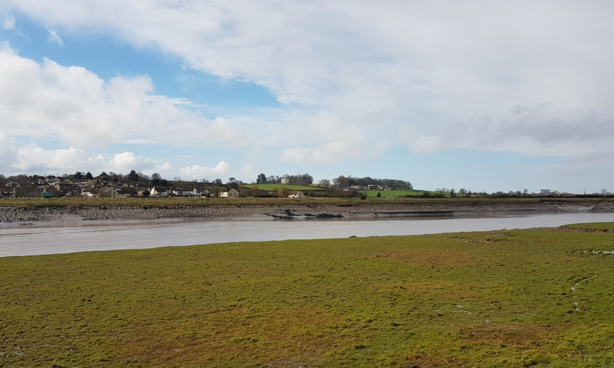


You must be logged in to post a comment.